17 Jul 2013
GEOELEC Geographical Information System

GEOELEC ThermoGIS
The GEOELEC project, co-funded by the Intelligent Energy Europe Programme of the EU, aims at promoting geothermal electricity generation in the EU and aims at removing notably financial and regulatory barriers.
GEOELEC has taken a step forward and has announced the official launch of the GEOELEC Geographical Information System – see here.
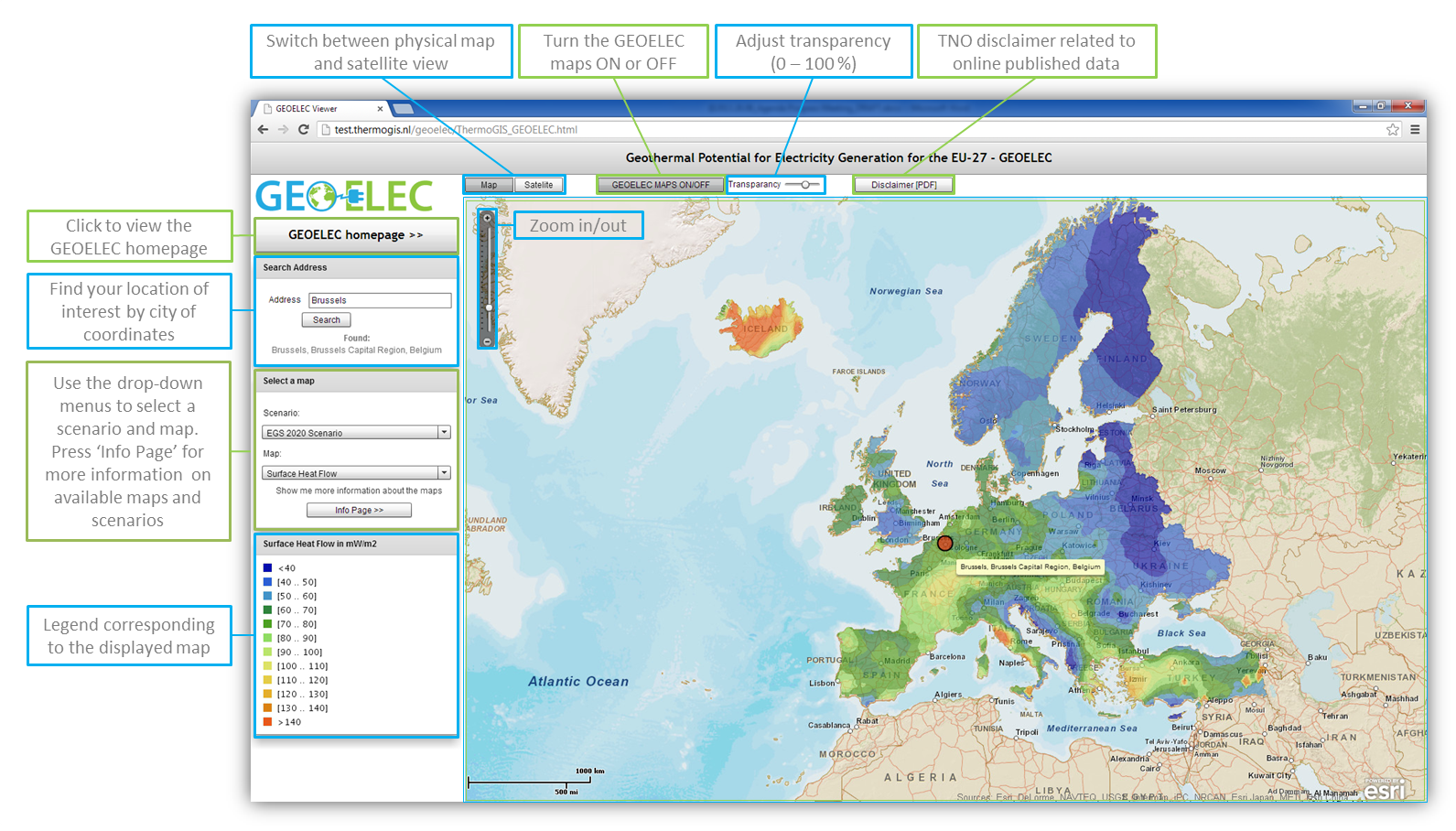
This unique system presents for the first time ever a geothermal resource assessment from 1 km to 5 km depth. Based on currently available information, it shows the estimated potential for geothermal electricity production in 2020 and 2050 in each of the EU-28 Member States, plus Norway, Iceland, Switzerland, and Turkey.
Check out the web of the GEOELEC Geographical Information System del Sistema de Información Geográfica (ThermoGIS) here.
To Access directly to the map, click on this link. There are small instructions to use the intective map here.
The methodology used to evaluate the geothermal resources can be seen in this presentation.
More information can be found on the GEOELEC website: www.geoelec.eu.